Buying Guide
Picking the best classroom wall maps starts with matching the map to the grade band and the wall space available, then checking the surface treatment and the depth of geography shown. The selections in this guide span early-elementary illustrated pairs through reference-grade maps intended for older students, so the right choice depends on how the map will actually be used day to day.
Match Size to Wall Space and Viewing Distance
Map size dictates who can read it and from where. Smaller 14" x 19.5" and 24" x 16" sets such as the Momo & Nashi kids pair or the 3D Learning LLF set work well at student eye level for close-up reference and learning centers, but may strain visibility from the back of a larger room. Mid-size 24" x 36" laminated pairs, including the Swiftmaps 24" x 36" 3D set and the 42 Curiosity USA and World set, balance wall footprint with readable detail. For whole-class visibility, the Rand McNally Classic Edition 50" x 32", the Swiftmaps 32" x 50" Pastel, and the RMC Classic 32" x 50" Pair step up to reference-grade dimensions, while the Maps International 46" x 80" map and the Swiftmaps 47" x 77" mega map function as classroom murals in auditoriums and shared spaces.
Prioritize a Durable, Classroom-Ready Surface
Classroom wall maps are touched, marked, and rehung often, so the surface treatment matters as much as the content. Most of the top classroom wall maps in this comparison use either 3 mil lamination, UV-coated lamination, or heat-sealed film, all of which are described as dry-erasable and resistant to tears or moisture. The Maps International giant map specifically mentions heat-sealed lamination between two sheets of industrial-quality film for whiteboard use. For younger grades, the Momo & Nashi set uses a waterproof plastic stock that does not need separate lamination, which simplifies maintenance.
Check Projection, Projection Style, and Terrain Detail
Not all world maps show the world the same way. Standard projections split or distort continents along the edges, while the Rand McNally Classic Edition uses an Africa-centered projection that keeps every country intact on a single sheet. For physical geography, the Swiftmaps 24" x 36" 3D pair and the RMC Classic 32" x 50" pair add shaded terrain relief that helps students visualize elevation and basins. Maps that include national flags, such as the Swiftmaps 36" x 48" World Classic Elite, layer civic context onto political geography.
Choose Age-Appropriate Visual Design
Visual design affects engagement as much as accuracy. Younger readers benefit from illustrated artwork, clear iconography, and larger type, all of which are described for the Momo & Nashi illustrated pair and the 3D Learning LLF starter set. Older students typically need denser political detail and a calmer color palette that holds up under longer reading sessions; the Swiftmaps Pastel 32" x 50" and the RMC Classic 32" x 50" pair target that grade band. Matching the visual style to the reader keeps the map usable across the school year.
Decide Between Singles and Coordinated Pairs
Single world maps such as the Maps International 46" x 80" or the Swiftmaps 36" x 48" World Classic Elite give the deepest coverage of global geography but require a separate US map. Coordinated pairs, including the 42 Curiosity 24" x 36" set, the Swiftmaps 24" x 36" 3D pair, and the RMC Classic 32" x 50" set, deliver consistent typography, color, and finish across both maps, which reduces visual confusion when students move between world and US contexts. Multi-topic sets, like the 3D Learning LLF world, US, and solar system posters, extend the classroom reference into science when desired.
Final Recommendation
Rand McNally Classic Edition World Wall Map (50" x 32", Laminated) ranks first overall in this specification-based comparison under the published weighted criteria.
The final choice among the best classroom wall maps depends on the documented features that match your intended use.
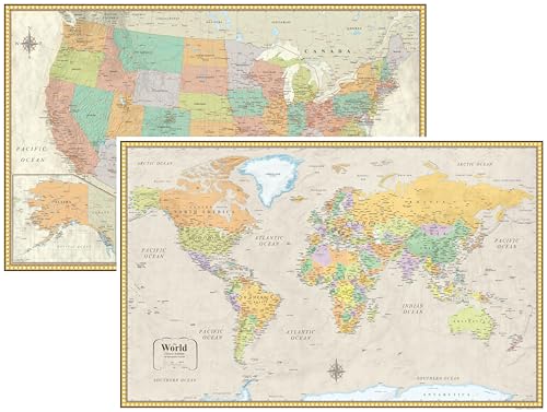
Among the top classroom wall maps reviewed, the Rand McNally Classic Edition World Wall Map earns the highest specification-based score and stands as the first overall choice for older classrooms that need a large, durable reference map with a distinctive Africa-centered projection. For teachers who want a matched USA and world pair in a consistent style, the 42 Curiosity USA & World Map Poster Set and the RMC Classic USA and World Wall Map Set are the most specification-aligned balanced options, while the Maps International Giant World Map is the best fit when maximum wall coverage is the priority. Together, these picks represent the most versatile classroom wall maps for varied grade levels and room sizes.
Frequently Asked Questions
Among the best classroom wall maps, what size classroom wall map works best for elementary students?
For elementary students, 24" x 16" illustrated sets such as the Momo & Nashi kids pair offer close-up readability at student eye level, while 24" x 36" pairs like the 42 Curiosity USA and World set add whole-class visibility without overwhelming younger readers.
Are laminated wall maps safe to use with dry-erase markers?
Yes, most of the best classroom wall maps in this guide are explicitly described as dry-erasable, including the Swiftmaps 32" x 50" Pastel, the Swiftmaps 47" x 77" mega map, the Maps International 46" x 80" giant map, and the RMC Classic USA and World set.
Do I need both a world map and a US map for a classroom?
A coordinated pair is usually the most efficient setup because it keeps typography and scale consistent across both maps, which is why the 42 Curiosity USA & World set, the Swiftmaps 24" x 36" 3D pair, and the RMC Classic USA and World set are common classroom configurations.
How do I choose between a flat political map and a 3D terrain map?
Flat political maps prioritize clean boundary lines and labeling, which suits younger readers and quick reference, while 3D terrain maps such as the Swiftmaps 24" x 36" 3D pair add shaded relief that supports physical geography lessons on elevation, mountains, and basins.
Which classroom wall maps hold up best in high-traffic rooms?
Maps that combine thicker poster paper or plastic stock with UV-coated or heat-sealed lamination, such as the Maps International 46" x 80" giant map and the Swiftmaps 36" x 48" World Classic Elite, are described as the most durable for repeated classroom handling.