Buying Guide
The best wall maps combine accurate cartography with construction that suits where they will hang. Use the sections below to compare size, finish, projection, and educational fit before you choose among the top wall maps in this roundup.
Match the projection and coverage to the wall
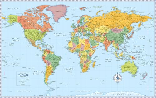
Projection choice determines how continents appear at the edges of a map. Most of the best wall maps in this comparison use a standard rectangular projection, while the Rand McNally Classic Edition World Wall Map stands out for its Africa-centered projection that keeps every continent intact. If you want to see each country without edge splits, an Africa-centered view can change the reading experience dramatically. For a US-only wall, a large US sheet such as the Rand McNally Classic Edition U.S. Wall Map or the Swiftmaps 48x78 Huge United States Wall Map gives full continental coverage without distraction.
Size, visibility, and wall space
Map size dictates how far away viewers can read place names. The National Geographic World Wall Map variants at 46 x 30.5 inches and 43.5 x 30.5 inches suit medium-sized rooms, while the Rand McNally 50 x 32 inch laminated series and the Swiftmaps 47 x 77 inch Mega Poster cover whole walls. When measuring wall space, leave clearance at the edges and account for the weight of the rolled tube that arrives in delivery.
Finish and durability choices
Two main finishes appear across the wall maps. Laminated sheets use a protective film that resists humidity, scuffs, and fingerprints. The National Geographic Executive and Classic laminated maps use 1.6 mil laminate, while the Decorator version uses thicker 3 mil laminate for extra wear resistance. The Swiftmaps flagships use UV-coated laminates that explicitly support dry-erase marking, which is helpful in classrooms and homeschool rooms. Paper-only maps, such as the National Geographic United States Wall Map Classic in its paper edition, are typically chosen when a separate wood frame from the publisher family will be added.
Reference credibility and cartographic detail
Cartographic detail varies by publisher. National Geographic maps document multi-source research using the United Nations, the U.S. Board on Geographic Names, and individual government policies, and that research pipeline carries across the Executive, Decorator, and Classic laminated world maps. Rand McNally documents 170 years of mapmaking heritage and made-in-the-USA production for the Classic and Signature world maps. Swiftmaps documents current political boundaries and adds the Flags of the World overlay on its 36x48 Classic Elite sheet.
Educational and display versatility
Some of the best wall maps pull double duty as decor and learning tools. Maps with dry-erase laminate, including the Swiftmaps 47x77 World Classic Premier and the Swiftmaps 48x78 Huge United States Wall Map, can be marked with whiteboard pens and wiped clean. Color-matched topographical relief on the Rand McNally Classic series adds depth for visual learning without overwhelming the political reference. For shared spaces, a pair of matching world and US maps at the same size creates a clean installation, which is one reason the 50 x 32 inch Rand McNally format is a frequent choice.
Every map in this roundup ships rolled rather than folded, which protects the print surface from creases along fold lines. Rand McNally documents a white cardboard tube with a cap, while Swiftmaps rolls its maps in standard tubes for crease-free arrival. Paper-only sheets ship ready for separate framing, while laminated sheets are ready to mount or hang as soon as they are unrolled.
Final recommendation
Rand McNally Classic Edition World Wall Map - 50 x 32 Laminated ranks first overall in this specification-based comparison under the published weighted criteria.
The final choice among the best wall maps depends on the documented features that match your intended use.
After comparing cartographic detail, projection, size, finish, reference credibility, versatility, and shipping, the Rand McNally Classic Edition World Wall Map is the first overall specification-based choice. It documents the largest 50 x 32 inch laminated sheet in the field, uses an Africa-centered projection that keeps every continent and country intact, adds color-matched topographical relief for at-a-glance physical geography, and is laminated for scuff and fingerprint resistance in classrooms, offices, and homes. Among the top wall maps compared here, it offers the most specification-aligned balance of visible area, projection choice, and reference construction. Buyers who prefer a US-only wall should pair that world map with the Rand McNally Classic Edition U.S. Wall Map, and shoppers who need a giant dry-erase canvas should consider the Swiftmaps 47x77 World Classic Premier Wall Map as the leading oversized alternative.
Frequently Asked Questions
What size should I choose for a wall map in a medium-sized room?
For medium-sized rooms, sheets in the 43 to 50 inch range work well. The National Geographic Classic and Decorator laminated world maps at 46 x 30.5 inches and the Rand McNally 50 x 32 inch series are good reference points. Measure your wall and leave clearance at the edges before ordering, since the largest sheets in this roundup reach 47 x 77 inches.
Are laminated wall maps better than paper wall maps?
Laminated sheets resist humidity, scuffs, and fingerprints, which makes them easier to maintain in classrooms and high-traffic offices. The National Geographic 1.6 mil laminate and the thicker 3 mil Decorator laminate are both designed for that purpose. Paper maps, like the National Geographic United States Wall Map Classic, are usually chosen when a separate wood frame will be added, since the paper accepts standard framing without the glare of a glossy surface.
Can I use a dry-erase marker on these wall maps?
Only maps that document dry-erase-safe laminate should be marked with whiteboard pens. The Swiftmaps 36x48 World Classic Elite, Swiftmaps 48x78 Huge United States Wall Map, and Swiftmaps 47x77 World Classic Premier all document dry-erase compatibility. Other laminated sheets may resist smudging but are not listed as dry-erase ready.
Which projection keeps every continent intact on a world wall map?
The Africa-centered projection on the Rand McNally Classic Edition World Wall Map keeps every continent and country complete and intact, avoiding the edge splits common in Pacific- or Atlantic-centered rectangular projections. Most of the other wall maps in this roundup use standard rectangular projections, which can cut landmasses at the edges.
What are the best wall maps for a classroom or homeschool setup?
For classroom and homeschool walls, the best wall maps combine a large, readable sheet with a durable finish and current political detail. Strong classroom picks include the Rand McNally Classic Edition World Wall Map, the Swiftmaps 47x77 World Classic Premier Wall Map, and the National Geographic World Wall Map Decorator, all of which document current political boundaries and protective laminate designed for repeated handling.