Buying Guide
Picking from the best political wall maps is easier when the decision starts with the geography you actually need to read from across the room. World, continental, and country-focused maps each solve a different reference problem, and the most specification-aligned wall usually layers two maps rather than relying on one.
Match the Map Scope to the Reference Task
A world political wall map shows how countries relate to each other, but at a given size it has to compress type and thin out minor borders to keep the map legible. A US-only wall map like the Maps International Large Political USA can dedicate far more of its surface to state names, capitals, and city dots, which is what most classrooms and home offices actually need. Continental maps such as the Maps International Large Political North America Wall Map cover trade-relevant regions in detail and pair naturally with a separate world map hanging next to them. For buyers covering broader global reference on a single wall, world maps from National Geographic, Maps International, Swiftmaps, and Rand McNally each take a different approach to country coloring and centering.
Read the Projection Before You Mount
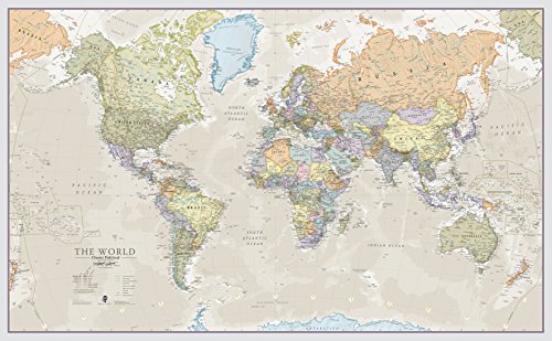
Most political wall maps use a familiar Atlantic-centered projection, which keeps the Americas on the left and Asia on the right. That works for many rooms, but it can split Pacific-rim countries across the edges. Choosing a projection is really about which oceans and countries you want to appear whole on the wall you already have.
Decide Between Lamination, Encapsulation, and Art Print
Surface treatment changes how a wall map behaves over years of use. Encapsulation lamination, used by the Maps International Large Political USA Wall Map and the Giant World Map, heat-seals the print between two plastic films so it can take dry-wipe markers. Front-sheet lamination is thinner and lighter, often chosen for framed wall maps where marking is not expected. National Geographic’s reference wall maps use 1.6 mil laminate for humidity resistance, while Swiftmaps applies 3mil laminate on faces like the Signature World Wall Map for heavier classroom dry-erase use. Polypropylene art prints such as the National Geographic World Classic Political Wall Map 36 x 24 inch are closer to a fine-art substrate: tear-resistant, framable, and not designed for marking.
Check Wall Height and Frame Stock Before Ordering
A 46 x 80 inch world mural like the Maps International Giant World Map looks impressive in a product photo but needs a clear wall span and often a custom frame. Smaller formats such as the 36 x 24 inch National Geographic World Classic Political Wall Map 36 x 24 in drop into standard art frames and are easier to reposition. Swiftmaps leans toward wide landscape formats like the 32 x 50 inch Signature poster, which fit nicely over a long sofa or behind a wide desk. Before ordering, measure the wall, then check the listed item dimensions for width, height, and any weight figures in the listing.
Look for Cartographic Detail Beyond Country Borders
Every map in this comparison shows country boundaries, but the supporting layers vary. National Geographic’s reference maps cite the U.N. and the U.S. Board on Geographic Names in their research process, and the Rand McNally Classic Edition World Wall Map adds color-matched topographical relief so elevation is readable in the same glance as the political boundaries. Maps International products add hill and sea shading across their world, US, and continental maps. For reference use, those shading layers often matter more than a slightly larger sheet size because they tell you why a country looks the way it does, not just where its borders fall.
Plan for Delivery and Mounting
Most political wall maps in this category ship rolled inside a tube to avoid creases, which is helpful because flat-folded maps rarely hang flat again. Larger rolls such as the Maps International Giant World Map and the Swiftmaps World Classic Premier 47 x 77 inch are heavy and benefit from a second person during unrolling and mounting. Lighter substrates like the National Geographic World Classic Political Wall Map 36 x 24 inch Polypropylene print can be mounted by one person with standard hardware.
Final Recommendation
Rand McNally Classic Edition World Wall Map Laminated 50 x 32 in ranks first overall in this specification-based comparison under the published weighted criteria.
The final choice among the best political wall maps depends on the documented features that match your intended use.
The Maps International Large Political USA Wall Map is the first overall specification-based choice for buyers who need a US-focused political reference with a write-on finish and a 36 x 48 inch footprint that fits the most common wall sizes in offices and classrooms. For a single-wall global reference, the National Geographic World Wall Map Classic Laminated 43.5 x 30.5 in is the safer specification-driven pick among the top political wall maps, combining reference-grade cartography with a 1.6 mil laminate build. Buyers who prefer a less common centering should look at the Rand McNally Classic Edition World Wall Map for its Africa-centered projection that keeps every continent intact on one sheet.
Frequently Asked Questions
Among the best political wall maps, what size political wall map reads best from across a room?
For most offices and classrooms, a 36 x 48 inch or 43.5 x 30.5 inch wall map balances country label size against wall fit. Smaller 36 x 24 inch art prints look great on a gallery wall but tend to have tighter type at distance, while 46 x 80 inch murals give the largest readable labels but require a clear wall section.
Are laminated political wall maps safe to write on?
Maps that use encapsulation lamination, such as the Maps International Large Political USA Wall Map, are designed for write-on, wipe-off marking with dry-wipe markers. Front-sheet lamination and Polypropylene art prints are generally not intended for regular marking and may smudge if used that way.
Which projection is best for a political wall map?
For rooms focused on Europe, Africa, and the Americas, an Atlantic-centered projection is familiar and readable. For Pacific-rim travel themes, a Pacific-centered layout places Asia and the Americas together. The Africa-centered projection used on the Rand McNally Classic Edition World Wall Map is a strong choice when you want every continent shown intact without edge splits.
Do I need a frame for a laminated wall map?
Lamination protects the printed surface from handling, but it does not stop wall-pin damage at corners or casual edge wear. A frame or mounting cleat extends the usable life of larger laminated maps, especially when the listing notes that the lamination edges are not heat-sealed.
How do I keep colors from fading over time?
Direct sunlight is the main risk to map color over years on a wall. UV-coated maps like the Swiftmaps World Classic Premier 47 x 77 inch add a layer of fade resistance, and even standard laminates last longer when hung away from south-facing windows or under a UV-filtering glazing in a frame.